Gustaf III Airport
Rémy de Haenen Airport Gustaf III Airport Saint Barthélemy Airport St. Jean Airport Aérodrome de St Jean | |||||||||||
|---|---|---|---|---|---|---|---|---|---|---|---|
 | |||||||||||
| Summary | |||||||||||
| Airport type | Public | ||||||||||
| Operator | Mairie de St Barthélemy | ||||||||||
| Serves | Saint Barthélemy | ||||||||||
| Location | St. Jean | ||||||||||
| Hub for | Tradewind Aviation | ||||||||||
| Elevation AMSL | 48 ft / 15 m | ||||||||||
| Coordinates | 17°54′16″N 062°50′38″W / 17.90444°N 62.84389°W | ||||||||||
| Map | |||||||||||
| Runways | |||||||||||
| |||||||||||
| Statistics (2023) | |||||||||||
| |||||||||||


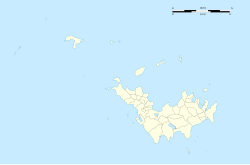
Gustaf III Airport[3] (IATA: SBH[3], ICAO: TFFJ[1]), also known as Saint Barthélemy Airport, Rémy de Haenen Airport, sometimes as St. Jean Airport (French: Aérodrome de St Jean[1]), is a public use airport located in the village of St. Jean on the Caribbean island of Saint Barthélemy.
Due to its very short runway, very close proximity to automotive traffic on a nearby road, and the necessity of a license to land at the airport, The History Channel documentary Most Extreme Airports ranked it the third most dangerous airport in the world, behind Toncontín International Airport and Lukla Airport. In spite of sensational videos and intense media coverage, the airport is regarded by experts as extremely safe and requires specialty certification for permission to land as a result of its unique features.
Overview[edit]
The airport is served by small regional commercial aircraft and charters. Most visiting aircraft carry fewer than twenty passengers, such as the Canadian-built De Havilland DHC-6 Twin Otter, a common sight throughout the northern West Indies and as a curiosity, the De Havilland DHC-7 is the largest aircraft ever allowed to operate at the airport. Additionally, a lightly-loaded Douglas DC-3 once managed to land at the airport, making it possibly the largest confirmed aircraft to land at St Barth.[4] The most common aircraft flying in for commercial service today are the Pilatus PC-12, Cessna 208B Grand Caravan, de Havilland DHC-6 Twin Otter, and Britten-Norman BN-2 Islander.
The short airstrip is at the base of a gentle slope ending directly on the beach. The arrival descent into runway 10 is extremely steep over the hilltop traffic circle; departing planes fly right over the heads of sunbathers (although small signs advise sunbathers not to lie directly at the end of the runway). The airport is located at the island's second-largest town, St. Jean.
History[edit]
Both the airport and the island's main town of Gustavia are named after King Gustav III of Sweden, under whom Sweden obtained the island from France in 1784 (it was sold back to France in 1878). In 1984, the Swedish Minister of Communications, Hans Gustafsson, inaugurated the terminal building of the Gustaf III Airport. In 2015 the airport got the name Aéroport de Saint-Barthélemy-Rémy-de-Haenen, named after Rémy de Haenen, an aviation pioneer and later mayor of Saint Barthélemy.[5] De Haenen first landed on the site of what would become the airport in 1946. At the time, the area was used as pasture land for sheep.
Between 2003 and 2005, the hilltop at the end of runway 10 was cleared lowered, and the road running up the hill was moved farther left (if looking up the hill from the airport) into this newly cleared area. This meant that cars did not have to drive directly under the approach path to the runway. This alteration of the famous approach came as part of a full renewal of the airport which culminated in its closing for six weeks in late 2004.[6]
Airlines and destinations[edit]
Passenger[edit]
| Airlines | Destinations |
|---|---|
| Air Antilles | Pointe-à-Pitre |
| St Barth Commuter | Antigua, Pointe-à-Pitre, Saint Martin, Sint Maarten |
| St Barth Executive | Pointe-à-Pitre, San Juan (begins June 17, 2024)[7] |
| Tradewind Aviation | Anguilla,[8] Antigua, Saint Thomas, San Juan |
| West Indies Helicopters | Anguilla, Antigua, Pointe-à-Pitre, Saba, Saint Martin, Sint Maarten |
| Winair | Antigua, Saba, Sint Maarten |
In addition to these scheduled services, charter airlines like Windward Express and Trans Anguilla Airways provide on demand flights to and from St. Barth.
Cargo[edit]
| Airlines | Destinations |
|---|---|
| DHL Aviation | Anguilla, Antigua, Fort-de-France, Grenada, Nevis, Pointe-à-Pitre, Saint Croix, Saint Kitts, Saint Thomas, Saint Vincent, San Juan, Sint Maarten, Tortola, Trinidad |
Statistics[edit]
Graphs are unavailable due to technical issues. There is more info on Phabricator and on MediaWiki.org. |
References[edit]
- ^ a b c TFFJ – Saint Barthélemy. AIP from French Service d'information aéronautique, effective 16 May 2024.
- ^ "Résultats d'activité des aéroports français 2018" (PDF). aeroport.fr. Retrieved 31 August 2019.
- ^ a b Great Circle Mapper – Gustaf III Airport (SBH / TFFJ)
- ^ "Short Matters". www.aopa.org. 8 May 2008. Retrieved 10 June 2024.
- ^ Aéroport Rémy de Haenen. St Barthélemy FWI
- ^ "What's New?". www.caribbeanflyingadventures.com. Retrieved 11 June 2024.
- ^ Liu, Jim (1 May 2024). "ST. BARTH EXECUTIVE LAUNCHES SCHEDULED OPERATION IN 2Q24". AeroRoutes. Retrieved 1 May 2024.
- ^ "Tradewind Aviation 1Q24 Anguilla Network Expansion". Aeroroutes. Retrieved 13 September 2023.
External links[edit]
![]() Media related to Gustaf III Airport at Wikimedia Commons
Media related to Gustaf III Airport at Wikimedia Commons

