Portal:Maryland
|
Maryland Portal
|
Baltimore Task Force
|
Frederick Task Force
|
Montgomery Task Force
|
WikiProject Maryland
|
|
Main page
|
Discussion
|
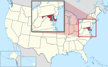
Introduction Maryland (US: /ˈmɛrɪlənd/ MERR-il-ənd) is a state in the Mid-Atlantic region of the United States. The state borders Virginia to its south, West Virginia to its west, Pennsylvania to its north, Delaware to its east, the Atlantic Ocean, and the national capital of Washington, D.C. With a total area of 12,407 square miles (32,130 km2), Maryland is the ninth-smallest state by land area, and its population of 6,177,224 ranks it the 18th-most populous state and the fifth-most densely populated. Maryland's capital is Annapolis, and the most populous city is Baltimore. Occasional nicknames include Old Line State, the Free State, and the Chesapeake Bay State. It is named after Henrietta Maria, the French-born queen of England, Scotland, and Ireland during the 17th century. Maryland's coastline was first explored by Europeans in the 16th century. Prior to that, it was inhabited by several Native American tribes, mostly the Algonquian peoples and, to a lesser degree, Iroquoians and Siouans. As one of the original Thirteen Colonies, Maryland was founded by George Calvert, 1st Baron Baltimore, a Catholic convert who sought to provide a religious haven for Catholics persecuted in England. In 1632, Charles I of England granted Lord Baltimore a colonial charter, naming the colony after his wife, Henrietta Maria. Unlike the Pilgrims and Puritans, Lord Baltimore envisioned a colony where people of different religious sects would coexist under the principle of toleration. In 1649, the Maryland General Assembly passed an Act Concerning Religion, which enshrined this principle by penalizing anyone who "reproached" a fellow Marylander based on religious affiliation. Nevertheless, religious strife was common in the early years, and Catholics remained a minority, albeit in greater numbers than in any other English colony. Maryland's early settlements and population centers clustered around rivers and other waterways that empty into the Chesapeake Bay. Its economy was heavily plantation-based and centered mostly on the cultivation of tobacco. Demand for cheap labor from Maryland colonists led to the importation of numerous indentured servants and enslaved Africans. In 1760, Maryland's current boundaries took form following the settlement of a long-running border dispute with Pennsylvania. Maryland was an active participant in the events leading up to the American Revolution, and by 1776, its delegates signed the Declaration of Independence. Many of its citizens subsequently played key political and military roles in the war. Although then a slave state, Maryland remained in the Union during the American Civil War, its strategic location giving it a significant role in the conflict. After the Civil War, Maryland took part in the Industrial Revolution, driven by its seaports, railroad networks, and mass immigration from Europe. Since the 1940s, the state's population has grown rapidly, to approximately six million residents, and it is among the most densely populated U.S. states. , Maryland had the highest median household income of any state, owing in large part to its proximity to Washington, D.C., and a highly diversified economy spanning manufacturing, retail services, public administration, real estate, higher education, information technology, defense contracting, health care, and biotechnology. Maryland is one of the most multicultural states in the country; it is one of the six states where non-Whites compose a majority of the population, with the fifth-highest percentage of African Americans, and high numbers of residents born in Africa, Asia, Central America, and the Caribbean. The state's central role in U.S. history is reflected by its hosting of some of the highest numbers of historic landmarks per capita. (Full article...) This is a Featured article, which represents some of the best content on English Wikipedia..
 The Maryland House of Delegates is the lower house of the Maryland General Assembly, the state legislature of the U.S. State of Maryland. Three delegates are elected from each district, though some districts are divided into sub-districts. In the original state constitution, four delegates were elected from each county to one-year terms, and two were elected from each of the major early cities of Baltimore and Annapolis. Reforms in the 1830s, however, led to the apportionment of delegates by population rather than geography, and by 1922, delegates served four year terms. The modern system of apportionment of seats began in 1972, when 47 districts of roughly equal population were identified, although sub-districts were created to ensure local representation for areas with too little population to warrant an entire district. Delegates are elected in even years when the President of the United States is not being elected, similar to most other state offices in Maryland. The most recent election was in November 2022. Delegates are not term-limited. (Full article...)General imagesIn the news
On this day...This is a Good article, an article that meets a core set of high editorial standards.
Jerome Daugherty SJ (March 25, 1849 – May 24, 1914) was an American Catholic priest and Jesuit who served in many different capacities at Jesuit institutions throughout the northeast United States, eventually becoming president of Georgetown University in 1901. Born in Baltimore, he was educated at Loyola College in Maryland, before entering the Society of Jesus and becoming a member of the first class at Woodstock College. He then taught various subjects, including mathematics, Latin, Ancient Greek, rhetoric, and the humanities in Massachusetts, New York City, and Washington, D.C., and served as minister at many of the institutions there. During his four-year leadership of Georgetown University, he oversaw several construction projects, the largest of which were the demolition of Old South Hall and its replacement with Ida Ryan Hall, and the construction of Hirst Library inside Healy Hall. He also continued his predecessor's work of reforming the curriculum, and managing tensions with the Catholic University of America. After his resignation, he continued his ministry in Maryland, Washington, and Philadelphia, before returning to New York, where he died. (Full article...)Selected article -The Star-Spangled Banner Flag House, formerly the Flag House & Star-Spangled Banner Museum, is a museum located in the Jonestown/Old Town and adjacent to Little Italy neighborhoods of eastern downtown Baltimore, Maryland, United States. Built in 1793, it was the home of Mary Young Pickersgill when she moved to Baltimore in 1806 and the location where she later sewed the "Star Spangled Banner," in 1813, the huge out-sized garrison flag that flew over Fort McHenry at Whetstone Point in Baltimore Harbor in the summer of 1814 during the British Royal Navy attack in the Battle of Baltimore during the War of 1812. The museum contains furniture and antiques from the Federal period as well as items from the Pickersgill family. (Full article...)Did you know?

SubcategoriesSelect [+] to view subcategories
TopicsRelated portalsAssociated WikimediaThe following Wikimedia Foundation sister projects provide more on this subject:
Discover Wikipedia using portals |


